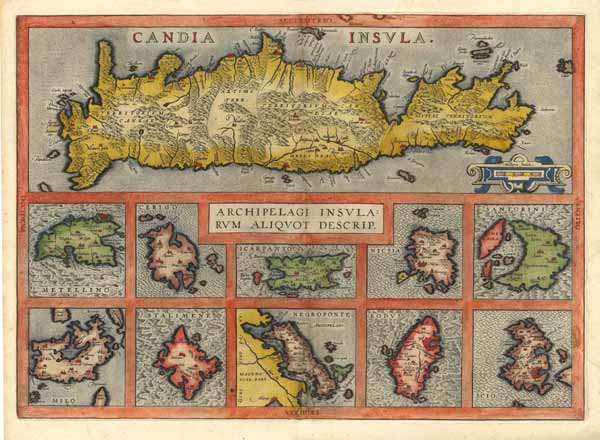
Altkolorierter Kupferstich v. Abraham Ortelius aus Theatre De L' Univers, Contenant Les Cartes De Tout le Monde. … b. Plantin Press (J. Moretus) in Antwerpen, 1598, 36 x 51 cm
van der Krogt, Koeman's Atlantes Neerlandici, Vol. III B, 7900+7910-31; M. van den Broecke, Orlelius Atlas Maps, S. 196 f., Nr. 147 mit Abb.; Zacharakis, A Catalogue of printed Maps of Greece 1477-1800 (2. edition 1992), S. 122, Nr. 1617 u. Abb. S. 351, Pl. 341. - Zeigt 11 Karten auf 1 Blatt: Die große obere Karte zeigt die griechische Mittelmeerinseln Kreta. - Darunter 10 kleinere Insetkarten mit den Inseln: Lesbos Metellino=(heute Mitilini, Stadt auf der griechischen Insel Lesbos), Kithira (Cerigo), Karpathos (Scarpanto), Naxos (Nicsia), Santorini, Milos (Milo), Lemnos (Stalimene), Euboea (Euböa / Negroponte), Rhodos (Rodvs) u. Chios (Scio). - Mittig in der Karte Kartusche mit Kartentitel in 2 Zeilen. - Mittig der Kartentitel.
Wir verwenden Cookies, um Ihren Warenkorb sitzungsübergreifend zu speichern.