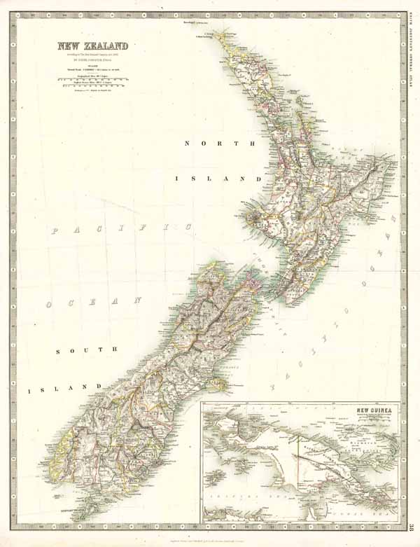
New Zealand - According to New Zealand Counties Act. 1876 By Keith Johnston, F.R.G.S. - Engraved, Printed and Published by W. & A.K. Johnston, Edinburgh & London. - 38
Altkolorierte Lithographie v. Keith Johnston aus Keith Johnstons General Atlas b. W. & A.K. Johnston in Edinburgh & London, dat. 1876, 57,5 x 44 cm
Tooley's Dic. of Mapm. Rev. Ed. E - J., S. 447 f. (W. & A.K. Johnston, fl. 1826 - 1901. Founded by Sir William Johnston. Engraver and printer, later publisher of 6 Hill Square, Edinburgh <from 1825>; …). - Zeigt Neuseeland mit der Nord- und der Südinsel, die durch die Cook-Straße voneinander getrennt sind. - Oben links Titel. - Unten rechts Insetansichtkarte von Neuguinea mit der Aufteilung von 1884 wo die Niederlande die Westhälfte der Insel bekam, Großbritannien den Südosten (Britisch-Neuguinea) und Deutschland den Nordosten (Kaiser-Wilhelms-Land).