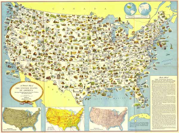
'A Pictorial Map of the United States of America: Showing Principal Regional Resources, Products and Natural Features - Published by The Departement of State Washington, D.C., U.S.A.': Farblithographie b. The Departement of State Washington, D.C, 1954, 59 x 79 cm
Dekorative USA Karte mit Einzeichnung der regionalen Bodenschätze, Produkte und lanschaftlichen Besonderheiten. - Am unteren Rand 3 Insetkarten mit den Haupt-Eisenbahnlinien, Haupt-Flugrouten und Gebiete sowie Haupt-Überlandstrassen. - Oben rechts westliche und östliche Hemisphäre mit Darstellung der relativen Größe und Lage der USA.
Scarce government issued pictorial map of the United States, prepared by the US State Department Washington. - At the bottom of the map 3 inset maps: Principal trunk-line railroads, Principal air routes and terrain and Principal trunk-line highways. - At the top right, Inset of Western and Eastern hemispheres showing relative size and location of the U.S.A.