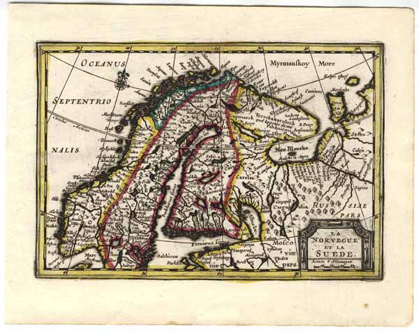
Altkolorierter Kupferstich aus Nouveau Petit Atlas ou Nouvelles Cartes Geographiques … b. Pieter van der Aa in Leiden, um 1714, 13,5 x 20 cm
Nicht bei van der Krogt, Koeman‚s Atlantes Neerlandici. - van der Krogt kennt die Karte nur im "Atlas Soulage" Part 2, aber nicht aus dem "Nouveau Petit Atlas". - Zeigt Skandinavien mit Norwegen, Schweden, Finnland, Estland und den nordwestlichen Teil von Russland. - Unten rechts eckige Titelkartusche mit Meilenzeiger. - Im Europäischem Nordmeer Windrose. - Extrem seltene Karte aus dem "Nouveau Petit Atlas" den Pieter van der Aa um 1714 herausgegeben hat. - Er verwendete fast alle Karten aus Janssonius‘s Atlas Minor als Grundlage und veränderte die Kartuschen, fügte Windrosen hinzu, entfernte alle Texte, Kustoden und Nummern sowie eine teilweise Veränderung der Typographie. - Van der Krogt kennt nur ein komplettes Exemplar des Atlases (der Atlas besteht aus 9 Teilen) in der Universitätsbibliothek Leiden. - Vorliegende Karte nicht in diesem Exemplar bekannt!
SKANDINAVIEN (Scandinavia / Scandia): ‚La Norvegue Et La Suede.‘: oldcoloured cooper-engraving from "Nouveau Petit Atlas ou Nouvelles Cartes Geographiques …" by Pieter van der Aa in Leiden (Netherland), 13,5 x 20 cm, ca. 1714
*Nicht bei van der Krogt, Koeman‚s Atlantes Neerlandici, Vol. III B. - The map shows Norway, Sweden, Finland, Estonia and the northwest part of Russia. - At the bottom right square titelcartouche with mileage scale. - In the northsea wind rose. - Extremely rare map from the "Nouveau Petit Atlas" appeared by Pieter van der Aa 1714. - He almost used maps from Janssonius‘s "Atlas Minor" as the basis and changed the cartouches, added wind roses, removed text, numbers and shelfmark and by a part of maps he changed the typography. - Van der Krogt knows only one complete copy of the atlas (the atlas consists of 9 parts) in the Leiden University Library. - This map not in the Leiden atlas!