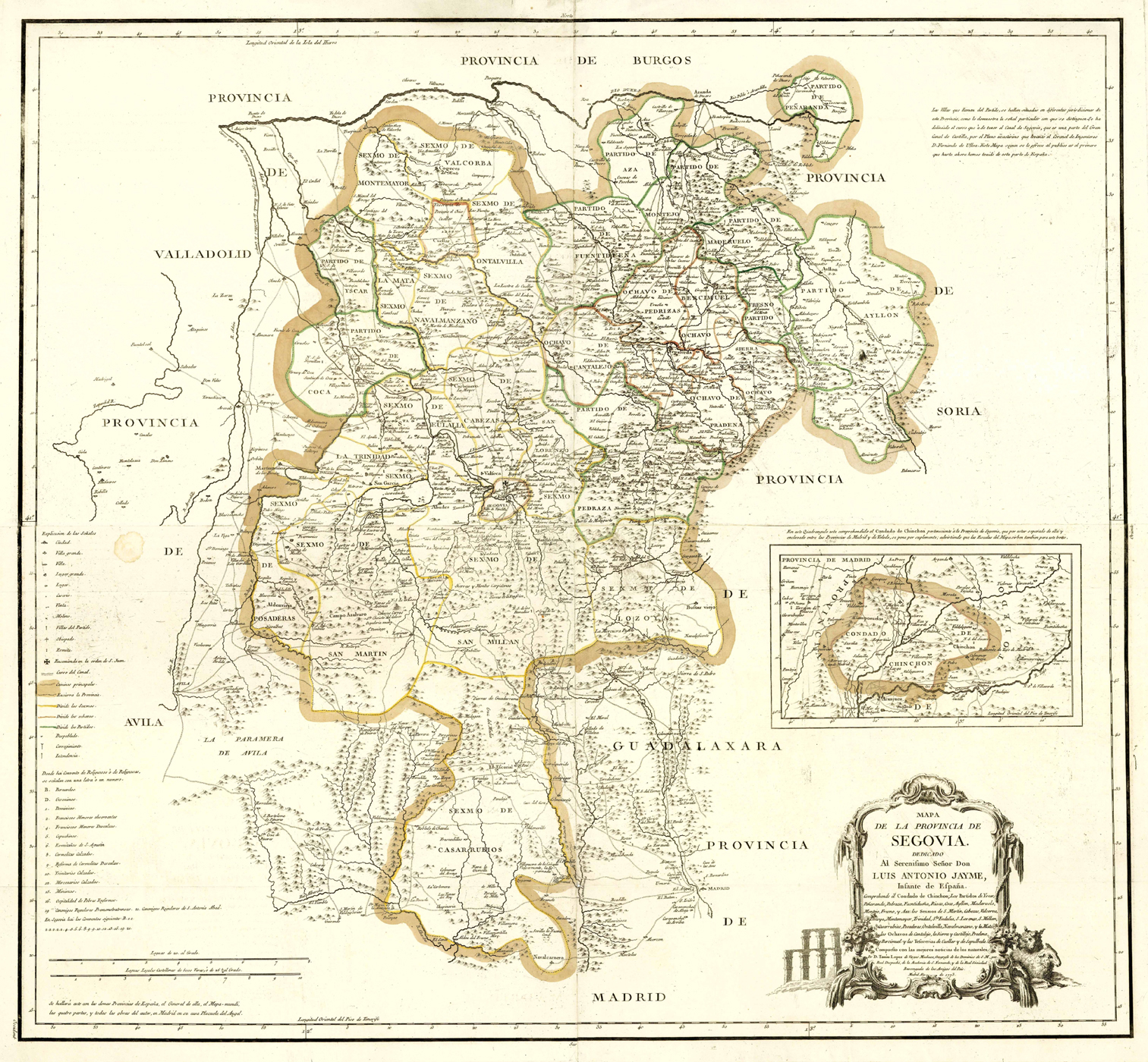
Mapa De La Provincia De Segovia. Dedicado Al Serenissimo Senor Don Luis Antonio Jayme, Infante de Espana - Comprehende el Condado de Chinchon, Los Partidos de Yscar, Peñaranda, Pedreza, Fuentidueña, Riaza, Coca, Ayllon, Maderuelo, Montejo, Fresno y Aza , Los Sexnos de S. Martín, Cabezas, Valcorva, Lozoya, Montemayor, Trinidad, Sta. Eulalia, S. Lorenzo, S. Millán, Casarrubios, Posaderas, Ontalvilla, Navalmanzano, y la Mata, los Ochavos de Cantalejo, la Sierra y Castillejo, Pradena, Bercimuel y las Tesorerias de Cuellar y de Sepulbeda ... Por D. Tomas Lopez de Vargas Machuca, ... Madrid Ano de 1773
Altkolorierter Kupferstich aus Atlas geografico de Espana b. Tomás López y Vargas Machuca in Madrid, dat. 1773, 74 x 81 cm
Tooley‚s Dic. of Mapm. Rev. Ed. K - P, S. 154 f. (Don Tomás López y Vargas Machuca, 1731-1802. B. and d. in Madrid. Spanish engraver and publisher, studied with d‘ Anville in Paris, returned to Madrid in 1760. During a 40-year career produced more than 200 maps. …) - Zeigt die spanische Provinz Segovia in der autonomen Region Castilla-León. - Mittig die Stadt Segovia. - Unten rechts Titelkartusche und Insetkarte der Grafschaft Chinchón ("Condado Chinchon"). - Am linken Rand Erklärungen und Maßstab. - Die Karte von 4 Platten gedruckt!
Map on four sheets. - Engraved outline hand colored map with title cartouche. Shows administrative divisions, major cities, towns, villages, landmarks, public buildings, roads, rivers, canals, forests and mountains. - Relief shown pictorially. - Includes explanation to symbols, descriptive text and alphanumeric key to convents and monasteries.