Beschreibung
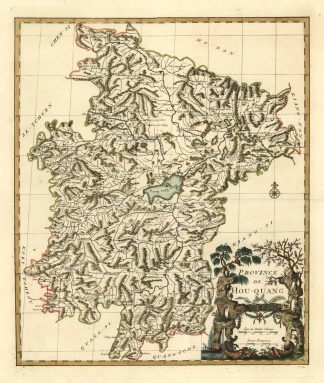
Koeman, Anv 1, (8); Tooley’s Dic. of Mapm. Rev. Ed. A – D, S. 396. – Zeigt die chinesische Provinz Hubei / Hunouang. – Unten rechts Titelkartusche. – Die Karte aus dem zweiten europäischem Atlas von China (Blaeu’s Atlas Sinensis war der Erste). – Shows the source of the Yang-tse -Kiang River in Lake Tong-ting-Hou (Dongting Sea), until the city of Wuhan (Ou-Tchang-Fou) on this map. – D’Anville’s map appered in du Halde’s Description geographique historique…de l’Empire de la Chine et de la Tartarie Chinoise. Based on Jesuit sources, D’Anville’s maps remained the definitive European rendering of China’s provinces until the end of the 19th century.