Beschreibung
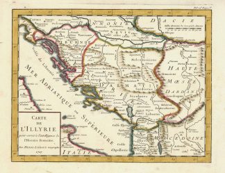
Tooley’s Dic. of Mapm. Rev. Ed. K – P, S. 132f. – J.B. Liebaux war in Paris ab 1679 tätig als Geograph und Kupferstecher für M. Thévenot, Nicolas de Fer, Nicolas Guérard und Guillaume Delisle. – Zeigt die Römische Provinz Illyrien (Geschichtskarte). – Unten links Titelkartusche – Roman province of Illyria (historical map).