Description
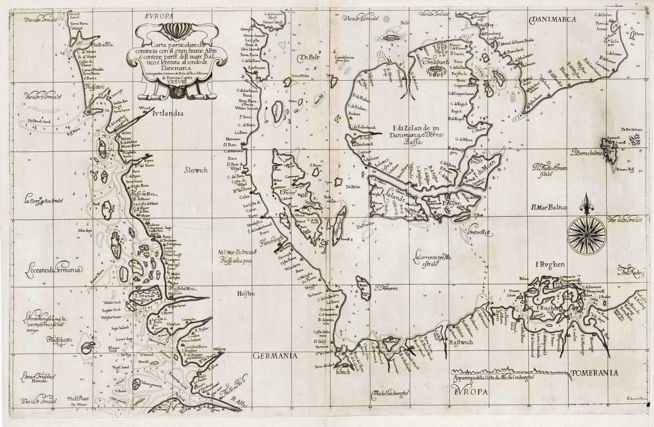
Tooley’s Dic. of Mapm. Rev. Ed. A – D, S. 395 (Sir Robert Dudley <self-styled Duke of Northumberland, Earl of Warwick>, 1573-1649. Born in Richmond, the illegitimate son of the Earl of Leicester. Engineer, explorer and geographer, active in Italy, died in Florence. Compiled chart atlas Dell’ arcano de mare, 1646-1647 <printed by Francesco Onofri; …; revised edition, Jcopo Bagnoni and Lucini 1661. Both editions include charts engraved by Antonio Francesco Lucini. First nautical atlas by an Englishman, and first nautical atlas with charts on Mercator projection.); Tooley’s Dic. of Mapm. Rev. Ed. K – P, S. 164 (Antonio Francesco <Anton Francesco> Lucini <Luchini>, born c. 1605 in Florence. Engraver and printer. Re-engraved the siege maps of Malta by d’ Aleccio, Disegni della Guerra … all’ Isola di Malta, Rome 1631, and later editions; engraved all plates for Sir Robert Dudley’s Arcano de Mare, Florence 1646-1647, 1661 <joint publisher with Jacopo Bagnoni>; a reduced version of 15 of the charts from the Arcano which may have been for a possible reduced format unpublished edition appeared recently. They have been attributed to Lucini and dated c. 1665.). – 1. Ausgabe der seltenen Seekarte von Schleswig, Holstein, den Nordfriesischen Inseln, Vorpommern mit Rügen und Dänemark mit dem Gebiet zwischen der Elbemündung, dem südlichen Jütland, der schwedischen Insel Hanö und dem Gebiet von Vorpommern mit Rügen. – Oben links Titelkartusche. – Am rechten Rand in der Ostsee Kompaßrose. – Sehr seltene Karte!