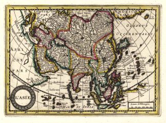
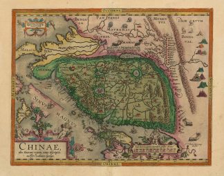
Description
van der Krogt, Koeman’s Atlantes Neerlandici, Vol. III 8410:31; 31:54/55 (Variant b); van den Broecke, Ortelius Atlas Maps, 164; Meurer, Fontes Cartographici Orteliani, S. 111 f. (Luiz Jorge de Barbuda); Suárez, Early Mapping of Southeast Asia, S. 170; Walter, Japan A Cartographic Vision, Farbabb. 11F. – Zeigt China mit Japan, den Philippinen, Nordborneo, Vietnam, Laos, Kambodscha, Thailand, Malakka Halbinsel, Malaysia und Bangladesch. – Rückseitig lateinischer Text. – (“Seit 1584 enthält das “Theatrum” diese China-Karte, die erste gedruckte und typenbildende China-Spezialkarte des Abendlandes” (Meurer) sowie die erste Karte mit Einzeichnung der Chinesischen Mauer. – 2. Zustand dieser Karte jetzt mit der Hinzufügung des Namen “Las Philippi= =nas. (Las Philippinas.)”. – Tadelloses altkoloriertes Exemplar!