MITTELAMERIKA (Central America):

950,00  inkl. MwSt.

‚Insulae Americanae In Oceano Septentrionali, cum Terris adiacentibus‘: Kupferstich v. Arnoldus Montanus aus Olfert Dapper: Die Unbekante Neue Welt, oder Beschreibung des Welt-teils Amerika, und des Sud-Landes b. Jacob van Meurs (Meursius) in Amsterdam, 1673, 28,5 x 36 cm

Einzelstück

Artikelnummer: 411776 Kategorien: ,

Beschreibung

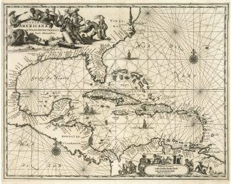
Burden, The Mapping of North America II, 414 – The map shows the West Indies, which also includes the east coast of North America from Chesapeake to the Gulf of Mexico, Central America and South America’s north coast. This map was based on the maps by Hessel Gerritsz from 1631 and William Blaeu’s in 1634. – Decorative map.